Efforts are being made to improve communication with and among those interested in wild rice.  This page will provide a location to share any current information (meetings, conferences, legislation, studies, reports, etc.) relating to wild rice.


DEVELOPING RELATIONSHIPS WITH THE UNIVERSITY OF MINNESOTA                                                                                   A number of tribal partners have been working with the University of Minnesota to develop efforts that support the understanding and preservation of wild rice.  An important component of this has been relationship building and forming appropriate partnerships.  A paper entitled Transforming Research and Relationships Through Collaborative Tribal-University Partnerships on Manoomin (Wild Rice) was published in Environmental Science and Policy (January 2021, online November 2020) that discusses this process.


SULFATE STANDARD TO PROTECT WILD RICE
Under Minnesota water quality rules, a 10 mg/L sulfate standard applies to "water used for the production of wild rice during periods when the rice may be susceptible to damage by high sulfate levels." Studies have been conducted to further evaluate the effects of sulfates on wild rice. Additional discussion is also occurring about defining waters used for the production of wild rice. Information resulting from these efforts will be used to determine if any changes in water quality standards are warranted. The Fond du Lac band led the development of reports in 2018 to further describe the importance of wild rice. Reports include: The Effects of Wild Rice Water Quality Rule Changes on Tribal Health, and The Food That Grows Out of the Water – The Economic Benefits of Wild Rice in Minnesota. In a corresponding process to the governor’s wild rice task force, the tribal wild rice task force completed the 2018 Tribal Wild Rice Task Force Report report in December 2018. More information can be found on the Minnesota Pollution Control Agency website: Minnesota's sulfate standard to protect wild rice .


MANOOMIN CULTURAL AND ECOSYSTEM CHARACTERIZATION
Through a cooperative effort led by the National Oceanic and Atmospheric Administration (NOAA), a number of partners worked together to describe the cultural and ecological importance of wild rice.  A final report Lake Superior Manoomin Cultural and Ecosystem Characterization Study was completed in May 2020.  The report also includes seven case studies that profile changes in wild rice cultural and ecological functionality over time at these sites.  In the 1854 Ceded Territory, cases studies included in the report and as separate documents are Big Rice Lake and Twin Lakes (Sandy and Little Sandy).


BIG RICE LAKE MANAGEMENT PLAN                                                                                   
An updated management plan for Big Rice Lake was completed in 2013 and is available at this link: Big Rice Lake Management Plan 2013. One notable change is a motorized restriction on the lake. (From June 15th through November 25th, motorized surface use will be restricted to watercraft with electric trolling motors only. Motorized access will be unrestricted the remainder of the year.) 


MANOOMIN                                                                                                                                                                                                A document entitled "Manoonim" was completed in December 2019 by Peter and Lisa David (employees of the Great Lakes Indian Fish & Wildlife Commission).  It provides a great overview of wild rice and also discusses issues in Wisconsin.


HARVESTER INPUT MEETINGS
In early 2007, a series of meetings was conducted in several locations across Minnesota and Wisconsin to gather input from ricers on a variety of issues, specifically on the concept of developing some form of a wild rice council or advisory group. A report entitled "A Summary of Wild Rice Harvester Meetings in Northern Minnesota and Wisconsin" by Annette Drewes is available. 


NATURAL WILD RICE IN MINNESOTA
The Minnesota Department of Natural Resources (with input from a variety of partners) completed a report entitled "Natural Wild Rice in Minnesota" in February 2008. The report contains a wide variety of information on wild rice including biology, distribution across Minnesota, management considerations, and recommendations.


WILD RICE HARVESTER SURVEY REPORTS
The Minnesota Department of Natural Resources completed a report entitled "Minnesota Natural Wild Rice Harvester Survey: A Study of Harvesters' Activities and Opinions" in December 2007. The report summarizes information obtained from a survey of wild rice harvesters conducted in late 2006 and early 2007.  The University of Minnesota conducted a survey in 2019 of Minnesota licensed wild rice harvesters and completed a report entitled "Protecting the Harvest: A Survey of Minnesota State (Non-Tribal) Wild Rice Harvesters."  The Minnesota Department of Natural Resources conducted a survey of wild rice harvesters in 2022 with results summarized in "2022 Wild Rice Harvester Survey."


ST. LOUIS RIVER ESTUARY WILD RICE RESTORATION
A report entitled "Wild Rice Restoration Implementation Plan for the St. Louis River Estuary" was completed in November 2014, for the Minnesota Department of Natural Resources in cooperation with a number of partners.  The report highlights potential areas in the estuary for wild rice restoration.  Restoration of wild rice beds in the St. Louis River began in 2015.  Under a process led by the Wisconsin Department of Natural Resources, an updated "St. Louis River Estuary Manoomin Restoration and Stewardship Plan" was completed in 2024.


WILD RICE MONITORING HANDBOOK AND FIELD GUIDE                                                 
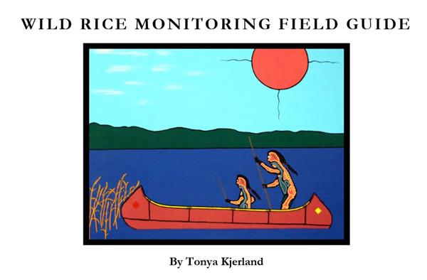
A handbook and field guide published in 2015 provide a standardized method for assessing trends in wild rice abundance and measuring wild rice productivity.  The documents are available on the Minnesota Sea Grant website.
  

WILD RICE LINKS    

Bois Forte Reservation

Fond du Lac Resource Management

Great Lakes Indian Fish & Wildlife Commission

White Earth Land Recovery Project

Minnesota Department of Natural Resources

Native Wild Rice Coalition

LICENSE REQUIREMENTS

Bois Forte and Grand Portage members must have an 1854 Treaty Authority identification card or valid Tribal identification card (or state license) in their possession to harvest wild rice within the 1854 Ceded Territory or within Minnesota.  The season dates, hours, and any special regulations are designated annually by the 1854 Treaty Authority. The 1854 Treaty Authority Conservation Code should be consulted for other wild rice harvest regulations for Bois Forte and Grand Portage members. 

Tribal band members may use a valid tribal identification card from a recognized tribe in Minnesota to harvest wild rice within Minnesota. Other harvesters are required to obtain a state license. The Minnesota Hunting and Trapping Regulations Handbook issued annually by the Minnesota Department of Natural Resources summarizes wild rice harvest regulations and license requirements/fees.

HARVEST SEASON

On most waters, it is the responsibility of harvesters to make the proper determination when wild rice is ripe and ready for harvest (generally late August or early September in northeastern Minnesota). However, the harvest of green or unripe rice is illegal and may result in prosecution. For the protection of the resource and to avoid damage to the crop, ricers should ensure suitable ripening has occurred before harvesting. Each year, a few select wild rice waters may be posted closed for harvest by conservation officers or other authorized agents. These closures are posted at known access points. Waters will then be posted open when the wild rice is determined ripe and ready for harvest.

2024 WILD RICE SEASON - 1854 TREATY AREA (for Bois Forte and Grand Portage members)

SEASON DATES: August 15 (and when ripe) - October 30

HARVEST HOURS: 9:00 a.m. - 5:00 p.m. daily

SPECIAL REGULATIONS:  No waters are planned to be posted with opening harvest dates. If waters are selected for posting in 2023, notification will be on the 1854 Website, and signage will be placed at known access points. 

RESERVATION RESTRICTIONS 

All wild rice within the boundaries of Indian Reservations is managed by the respective Reservation. In the 1854 Ceded Territory, the Bois Forte, Grand Portage, and Fond du Lac reservations manage the wild rice within their own boundaries. Typically, only Tribal members or those persons receiving proper authorization are allowed to harvest wild rice within Reservation boundaries. Wild rice committees establish the opening date, days, and hours of harvest. Please contact the appropriate Reservation staff for specific rules and for more information.

The 1854 Treaty Authority provides wild rice condition updates on waters included in the wild rice monitoring program, and on other lakes and rivers as information becomes available.  Updates are provided periodically throughout the growing season and as harvest time approaches.  Some information shared from other partners including the Minnesota Department of Natural Resources.  Additional condition and other information can be found on the Minnesota Department of Natural Resources wild rice page.  A heavy rain event in June (6/18/2024) resulted in high water and flooding across parts of the region, likely impacting wild rice production this season.  Aerial photos were taken on 8/12/2024 and 9/6/2024 in cooperation with the Minnesota Department of Natural Resources, Fond du Lac Band, 1854 Treaty Authority, and U.S. Forest Service.

Water Body Location Date Wild Rice Conditions Photos
Big Rice Lake FR #247, N of Virginia 8/20/24 sparse wild rice across center of lake, most plants standing 1-2 feet, seeds mostly empty, many stalks nipped or broken

8/20/24

8/20/24

8/20/24

8/20/24

8/12/24

8/12/24

Breda Lake CR #44, N of Brimson (paddle down Petrel Creek) 8/23/24 moderate density wild rice on north end of lake, sparse wild rice and other thicker vegetation across most of lake, wild rice plants standing up to 12-18 inches, seeds mostly empty with some milky

8/23/24

8/23/24

8/23/24

9/6/24

Cabin Lake FR #359, E of Isabella (rough access road) 8/28/24 sparse to moderate density wild rice across most of lake, most plants standing 1-2 feet, most seeds empty or milky

8/12/24

8/28/24

8/28/24

8/28/24

Campers Lake CR #2 W of Isabella (paddle down Stony River) 8/27/24 sparse wild rice along shore, mostly open water in center, plants standing 1-1.5 feet, seeds empty

8/27/24

8/27/24

9/6/24

Cramer Lake CR #7, NE of Finland 8/28/24 good density wild rice in northeast portion of lake, moderate or sparse elsewhere, most plants standing 1-2 feet, most seeds empty or milky, some filling out

8/12/24

8/28/24

8/28/24

8/28/24

8/28/24

Kettle Lake Kettle Lk Rd (off Hwy 210), SE of Cromwell 8/21/24 sparse wild rice plants along shore, most plants short, open water across most of center of lake

8/21/24

8/21/24

9/6/24

9/6/24

Little Rice Lake CR #304, N of Virginia 8/22/24 sparse wild rice plants, thick other vegetation (watershield)

8/12/24

8/22/24

8/22/24

Round Island Lake FR #172, E of Isabella (rough access road) 8/27/24 thick other vegetation (watershield) across lake, no wild rice plants observed

8/12/24

8/27/24

8/27/24

8/27/24

Stone Lake FR #120, E of Hoyt Lakes (longer carry-down) 8/26/24 sparse wild rice plants, thicker areas of other vegetation, high water

8/26/24

8/26/24

8/26/24

9/6/24

Vermilion River FR #4538, W of Crane Lake 8/19/24 generally a thin strip of sparse wild rice along river channel near Goldmine Resort, some smaller areas of moderate to good density wild rice, most plants standing 1-2 feet, some taller, most seeds empty with a few becoming milky   

8/19/24

8/19/24

8/19/24

8/19/24

8/12/24

Clark Lake CR #2, N of Two Harbors 9/6/24 appears sparse to moderate density across parts of lake (viewed from air)

8/15/24

9/6/24

9/6/24

Leeman Lake Hwy #73 (Ricehaven Road), S of Floodwood 8/14/24 no wild rice visible from shore, thick other vegetation (mostly watershield)

8/14/24

8/14/24

8/14/24

9/6/24

Wolf Lake CR #547, W of Brimson 8/5/24 sparse to moderately dense wild rice along shore, most plants standing 1 foot, some taller and flowering, many plants nipped off

8/5/24

8/5/24

9/6/24

9/6/24

Tommila Lake FR #412, N of Brimson (longer carry-down) 8/5/24 moderate density wild rice on south end of lake, sparse elsewhere, plants standing 12-16 inches, access trail getting over-grown

8/5/24

8/5/24

9/6/24

St. Louis River FR #795 (Skibo), E of Hoyt Lakes 8/15/24 moderate to good density wild rice along parts of riverbank, less wide and dense than many years, sparse areas also, plants standing 1-1.5 feet, plants flowering but seeds still empty 

8/15/24

8/15/24

8/15/24

9/6/24

St. Louis River FR #130 (Norway Point), S of Hoyt Lakes 8/15/24 sparse wild rice observed from shore, plants standing 1.5-2 feet, flowering but seeds still empty, thicker other vegetation (pickerelweed)

8/15/24

8/15/24

9/6/24

Turpela Lake CR #100, S of Aurora 8/15/24 appears sparse wild rice across most of lake, plants standing 1-2 feet (viewed from road)

8/15/24

8/15/24

9/6/24

Moose Lake CR #461, W of Britt (FR #11367 longer carry- down or ATV) 8/15/24 sparse wild rice along parts of shore, some plants flowering 

8/15/24

8/15/24

8/15/24

8/12/24

Island River FR #377/379, N of Isabella 8/15/24 sparse to moderate density wild rice along river channel (FR #377) and across river stretch (FR #379)

8/15/24

8/15/24

8/12/24

McDougal lakes FR #106, W of Isabella 9/6/24 appears areas of sparse wild rice (viewed from air)

9/6/24

9/6/24

Fourmile Lake FR #170, N of Tofte 8/12/24 appears sparse wild rice in western bay (viewed from air)

8/12/24


Greenwood Lake CR #2, N of Two Harbors 8/15/24 sparse wild rice along shore viewed from public access, sparse wild rice on north and south ends (viewed from air)

8/15/24

9/6/24

9/6/24

Tamarack River / Tamarack Lake Hwy #210, near Wright 9/6/24 areas of sparse to moderate density wild rice in river near highway and in narrows of lake

9/6/24


Tamarack River / Long Lake Hwy #210, near Wright 9/6/24 appears sparse wild rice, other thicker vegetation (viewed from air)

9/6/24


Mark Lake FR #161, W of Grand Marais 8/15/24 sparse wild rice along shore on east end, plants standing 1-2 feet, many flowering

8/15/24

8/12/24

8/12/24

Elbow Lake CR #12 (Gunflint Trail), N of Grand Marais 8/12/24 appears sparse wild rice in south bay, other thicker vegetation, (viewed from air)

8/12/24


Northern Light Lake CR #12 (Gunflint Trail), N of Grand Marais 8/12/24 appears sparse wild rice on east end (viewed from air)

8/12/24

8/12/24

Moosehorn River CR #61, S of Moose Lake 8/14/24 fair to good density wild rice along riverbanks, rice standing 3-4 feet and flowering, thinner strip and areas of other vegetation (pickerelweed) moving downstream

8/14/24

8/14/24

8/14/24

8/14/24

9/6/24

Birch Lake CR #407, N of Babbitt 8/15/24 moderate to good density in small bays near access on west end, plants flowering and standing 1.5-2.5 feet, seeds still empty, generally sparse wild rice along channel on west end

8/15/24

8/15/24

8/12/24

8/12/24

Swamp River CR #16 (Arrowhead Trail), or Otter Lake Road, N of Hovland    


Cloquet Lake FR #102, W of Finland 9/6/24 appears sparse wild rice with some areas of moderate density (viewed from air)

9/6/24

9/6/24

Sand River Hwy #169, N of Virginia 8/12/24 appears areas of moderate to good density wild rice along river channel (viewed from air)

8/12/24


Pike River CR #26, S of Tower    


Little Indian Sioux River CR #116 (Echo Trail), E of Buyck 8/12/24 appears sparse wild rice along river channel (viewed from air)

8/12/24


Butterball Lake FR #795, E of Hoyt Lakes 9/6/24 appears sparse to moderate density wild rice (viewed from air)

9/6/24


Little Butterball Lake FR #795, E of Hoyt Lakes 9/6/24 appears sparse to moderate density wild rice (viewed from air)

9/6/24


Seven Beaver Lake FR #418, E of Hoyt Lakes (difficult access) 9/6/24 no wild rice observed (viewed from air)

9/6/24


Round Lake FR #418, E of Hoyt Lakes (difficult access) 9/6/24 appears sparse wild rice (viewed from air)

9/6/24

9/6/24

Legler Lake CR#2, N of Two Harbors (Kane Lake Rd, FR #839, ATV trail) 9/6/24 appears sparse to moderate density wild rice (viewed from air)

9/6/24


Sand Lake CR #2, N of Two Harbors 9/6/24 appears sparse wild rice (viewed from air)

9/6/24


Stony Lake CR #2, N of Two Harbors 9/6/24 appears sparse wild rice (viewed from air)

9/6/24

9/6/24

Papoose Lake CR #44, N of Duluth (canoe river from Indian Lake) 9/6/24 appears sparse wild rice (viewed from air)

9/6/24


Stone/East Stone/West Stone Lakes CR #319, S of Zim 9/6/24 appears sparse to moderate density wild rice in East Stone Lake, sparse wild rice in Stone Lake and West Stone Lake (viewed from air)

9/6/24

9/6/24

9/6/24

Wabuse/Washusk #1/Washusk #2 Lakes CR#351, E of Cotton (difficult accesss) 9/6/24 appears sparse wild rice (viewed from air)

9/6/24

9/6/24

9/6/24

9/6/24

(CR - county road,  FR - forest road,  HWY - highway) 

Friendly reminders:

  • Access to some lakes may be difficult. Please plan ahead and check into access before heading out.
  • These updates are not a complete list of conditions in the 1854 Ceded Territory this year. Only lakes and rivers that we have reports on are listed. Scouting other potential rice waters may lead to success.
  • It is illegal to harvest unripe wild rice. Please be sure that the rice is ripe and ready for harvest.  


Posting opening dates:

In the 1854 Ceded Territory, no lakes/rivers are planned to be posted with opening dates for wild rice harvest in 2024.  Information will be provided here if that changes.  Unless specifically posted, waters are open by the "green rice law", meaning that they are open for harvest when stands are ripe (and within the season beginning August 15th).  It is the responsibility of ricers to properly make this determination.

Wild Rice Resource Guide has been developed by the 1854 Treaty Authority. This guide provides information on locations in the 1854 Ceded Territory where wild rice could be harvested. 

Although conditions on given lakes/rivers obviously change each year, the guide lists areas in recent years that have contained enough wild rice to be harvested. In addition, a list of all wild rice waters within the 1854 Ceded Territory is included. The 5th edition of the guide (updated in 2020) lists 110 lakes/rivers classified as having good or fair potential to contain harvestable wild rice. The guide will be revised again in the future as new or better information on wild rice waters in the 1854 Ceded Territory is acquired.

The Wild Rice Resource Guide also contains information about wild rice biology, harvest regulations, and traditional harvesting/finishing.

The Wild Rice Resource Guide is available on the reports page or by contacting the 1854 Treaty Authority.